KaTron’s TERRAtron™ is a next-generation Terrain Simulation Server software that provides terrain database services for all kinds of simulation applications. TERRAtron™ processes very large scale gridded elevation data and enables real-time queries on these data.
TERRAtron™ is the perfect solution for applications requiring real-time terrain analysis/information like sensor, communication and navigation simulaton.
TERRAtron™ processes terrain databases based on industry standard formats like OpenFlight and NIMA DTED and converts these to a triangular grid format without any loss of precision.
This enables optimized terrain loading and multiple simultaneous real-time terrain query operations
TERRAtron™ Features
- Client – Server, Multi-Platform Architecture
- HLA Interface
- TCP/IP, IDP Interface
- Graphical User Interface (GUI)
- Real-time Calculations and Queries
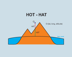
- Height of Terrain
- Height above Terrain
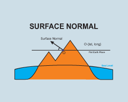
- Surface Normal
- Line of Sight
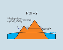
- Point of Intersection – POI on terrain between two points
- Point of Intersection – POI on terrain on circle with given radius
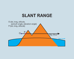
- Slant Range
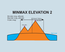
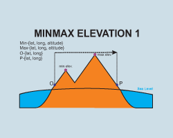
- MIN/MAX Points between two points on line
- MIN/MAX Points on circle with given radius
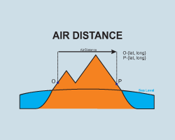
- Air Distance of two points on terrain
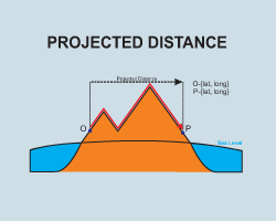
- Projected Distance of two points on terrain
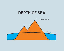
- Depth of Sea
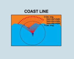
- Coast Line
TERRAtron™ Document
PDF (0,5MB)![]()